
Starting off in Pinole, this “twisties” route will take you all the way to San Jose.
North Bay - Ralle de Napa
This is an old driving route that we used for our annual Ralle de Napa event. It starts off in the parking lot at the Solano Community College and ends in St. Helena. This trip is best done in the late autumn or early spring when the temperature isn’t scorching hot.
South Bay - Alice's Restaurant to Santa Cruz
Starting off at the famous Alice’s Restaurant and heading south along Skyline Blvd to the surf town of Santa Cruz.
East Bay - Redwood Road to Grizzly Peak
This is one of the East Bay’s best kept secrets. This road takes you from Castro Valley north through the Oakland Hills, and ending up at the iconic scenic view point called “The Wall”. This road is a favorite among East Bay motorcycle enthusiasts.
North Bay - San Francisco to Skaggs Spring Road
Peninsula - Skyline to LaHonda
This is one of the most well known routes for Bay Area motoring enthusiasts.
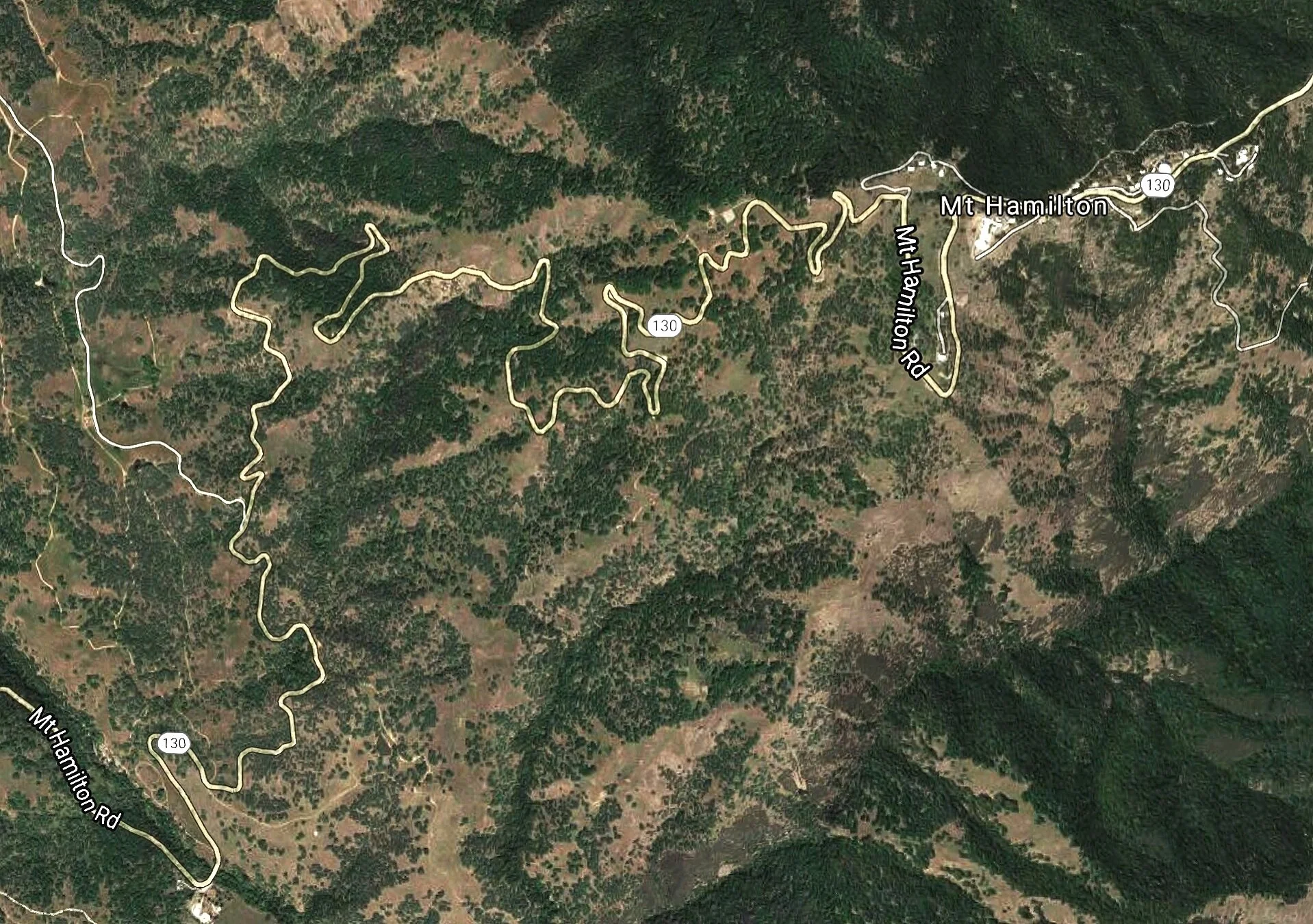
South Bay - Mt. Hamilton
East Bay Livermore to San Jose route
This route takes about 2-3hrs to complete on average. As with nearly every road on our list, it is advisable to get an early start before it becomes cluttered with spandex warriors, and clueless tourists/locals.
The road starts off in Livermore, and ends up in San Jose. At the beginning, you will be starting off on Mines Road. This road is mostly a tight, 2-way road without a center divide line. Be careful of on-coming traffic and blind corners. It is a good idea to stay conservative at this point.
Eventually, the road will widen, and the center line will re-appear. At this point, the pace can be pushed a bit more. About halfway through the route, you will come upon a diner called The Junction Bar & Grill. If you are in the mood for a burger, or bar food, stop and grab a bite. Otherwise, stay on the main road and keep going towards San Jose.
Once you are past the midway point, the road begins a steady climb up towards the summit. The corners around here are fairly tame and wide until you get closer to the base of the mountain. Then the roads tighten up, with lots of switchbacks, and sharp corners.
Slow down when you get towards the summit, and the Observatory as there is usually a lot of tourist traffic coming and going from there. The road down towards San Jose is very tight, and very technical so if your car is prone to understeer, I would take it easy. The route ends at the corner of Mt. Hamilton Rd and Alum Rock Rd.
Food Tip: Take a left, and go towards 680 south. Navigate your way to the Grand Century Shopping Mall food court Off Story Rd for a late lunch.
Address: 1111 Story Rd, San Jose, CA 95122